Saturday July 18th – Monday July 20th, 2020
Olympic National Park is massive and has several distinct regions, from rainforests, to beaches, to mountains. It’s quite the variety all within the same national park! Visitors typically start at the Olympic National Park Visitor Center and drive counter-clockwise along Highway 101. Given how large and spread out this park is, there’s a lot of driving each day. We spent 3 days and 2 nights at two different campsites here.
Campsites
Only three campsites in the park allow reservations online in advance: Sol Duc, Mora, and Kalaloch. The rest are first come first served. We like to have peace of mind, so these were the only three campsites we considered.
Sol Duc
We stayed at Sol Duc on the first night, since it is closest to the Hurricane Ridge area where we began our trip. The campground was nice, with flush toilets but no showers. We had read online that nearby Sol Duc Hot Springs offered showers we could pay for, but when we arrived, we were told they were not open to non-guests this summer.
Kalaloch
We loved the vibe of Kalaloch Campground. The sites were surrounded by big trees which gave it more of a feeling like we were camping in the great outdoors. Our site was very close to our neighbor and we could even hear their conversation, but it didn’t bother us. I also liked how you can access both a hiking trail and the beach directly from this campsite. There are flush toilets but no showers at this campsite.
Day 1 – Saturday
12:30pm – Olympic National Park Visitor Center
This is the main visitor center and it is easily accessible right off of Hwy 101. We stopped briefly to ask rangers a couple questions outside but couldn’t go in due to covid.
12:45pm – Drive to Hurricane Ridge Visitor Center
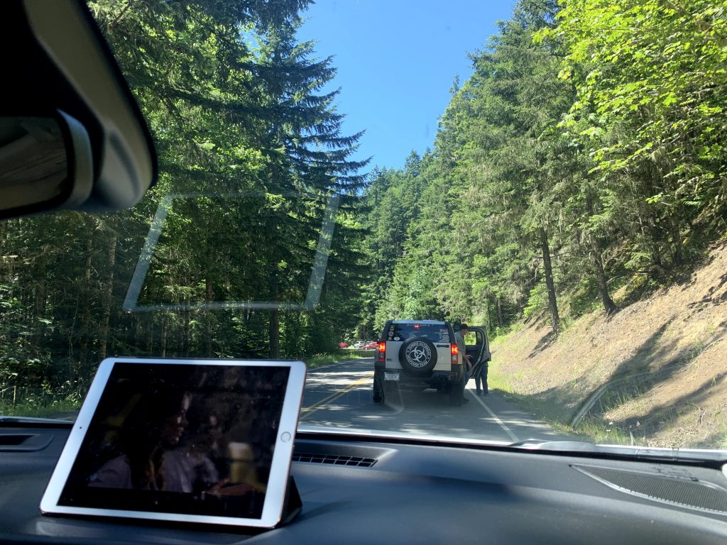
This drive should only take 35min, but it instead took 2hrs due to the insane traffic. I think covid made everyone desperate to go outside, so the last part of the drive was just sitting in a line waiting to be let in. We watched so many episodes of House.
2:45pm – Hurricane Ridge Visitor Center
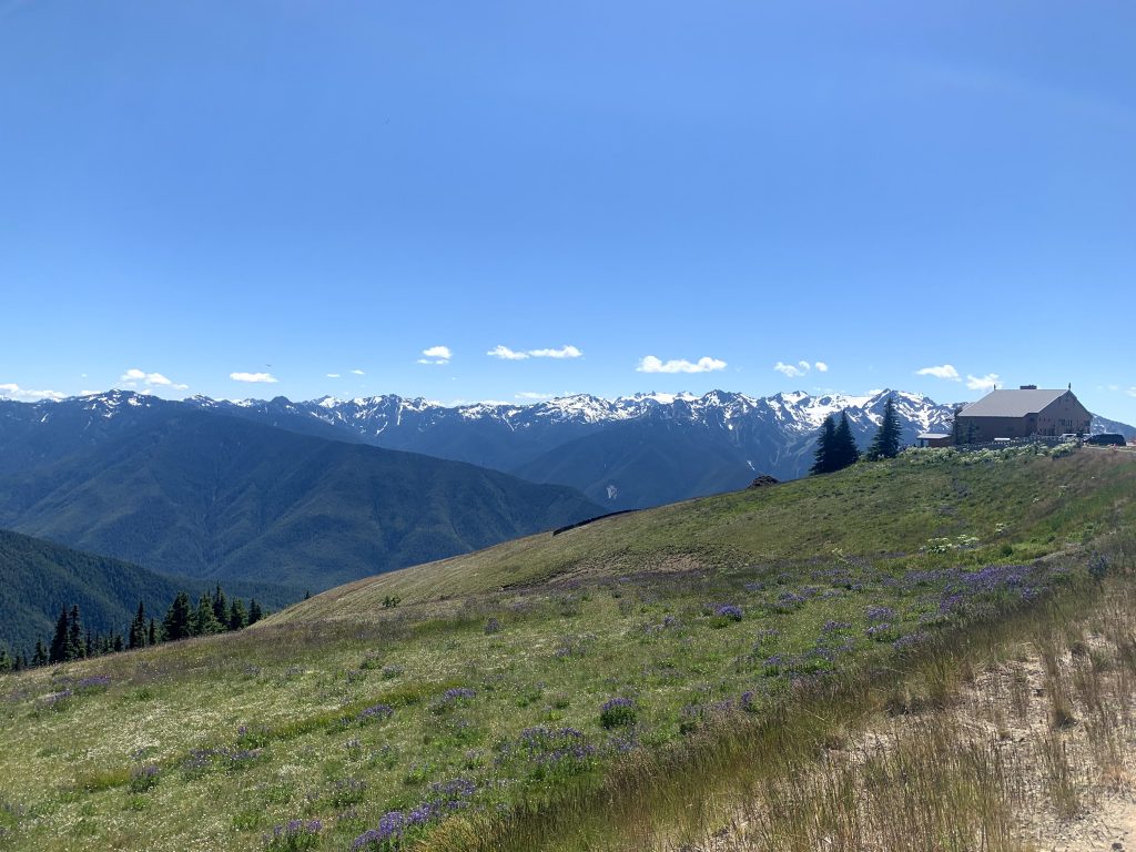
Hurricane Ridge is a section of the park that provides a great view of the surrounding area, from mountains to the sea, and even a brief glimpse of Canada. The Hurricane Ridge Visitor Center parking lot already offers a nice view. But to make the (supposedly 30min) drive down here worth your time, you can also hike short or long trails from this point.
3:00pm – Short hikes in the Klahhane Ridge area (0.5 mile High Ridge Trail, see Sunrise Point < 1 mile Cirque Rim Trail)
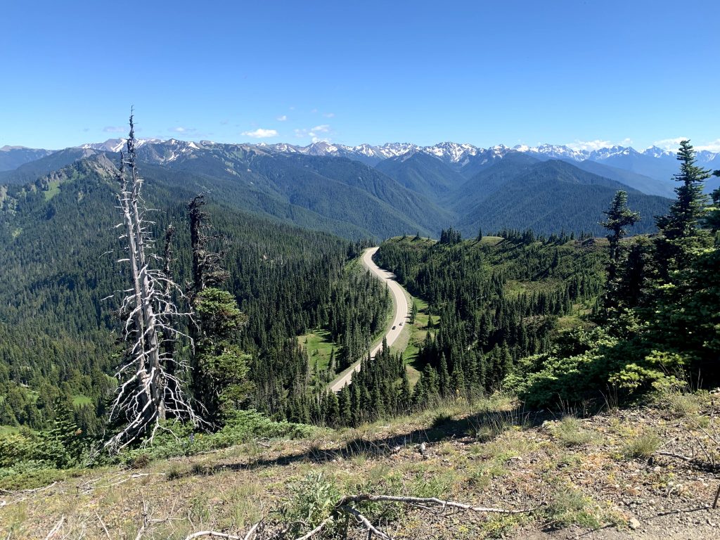
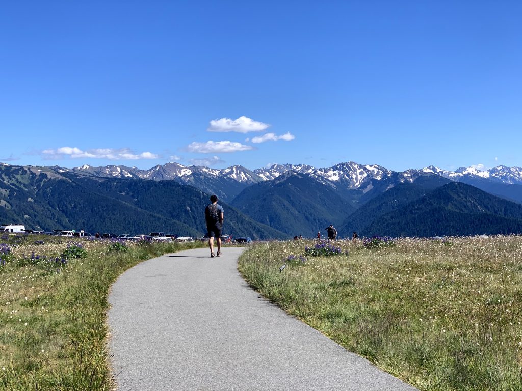
We chose to hike the short 0.5 mile High Ridge Trail, which took us to the top of an alpine hill. From here there’s a short path to Sunrise Point, where we could see Canada in the distance! After continuing down the loop, the trail connects with Cirque Rim Trail, another < 1 mile trail that winds along the ridge. We enjoyed these short trails because the refreshing views were worth the little effort it took. There are other longer and more difficult trails from the parking lot, like the Hurricane Ridge Trail, but we decided not to hike it because we were short on time and we assumed the views would not look much different from the short trails we hiked. Cirque Rim Trail took us back to the parking lot, then it was time for another drive.
5:00pm – Mount Storm King Trail (5.3 mi, 2,076 ft elevation gain, out & back)
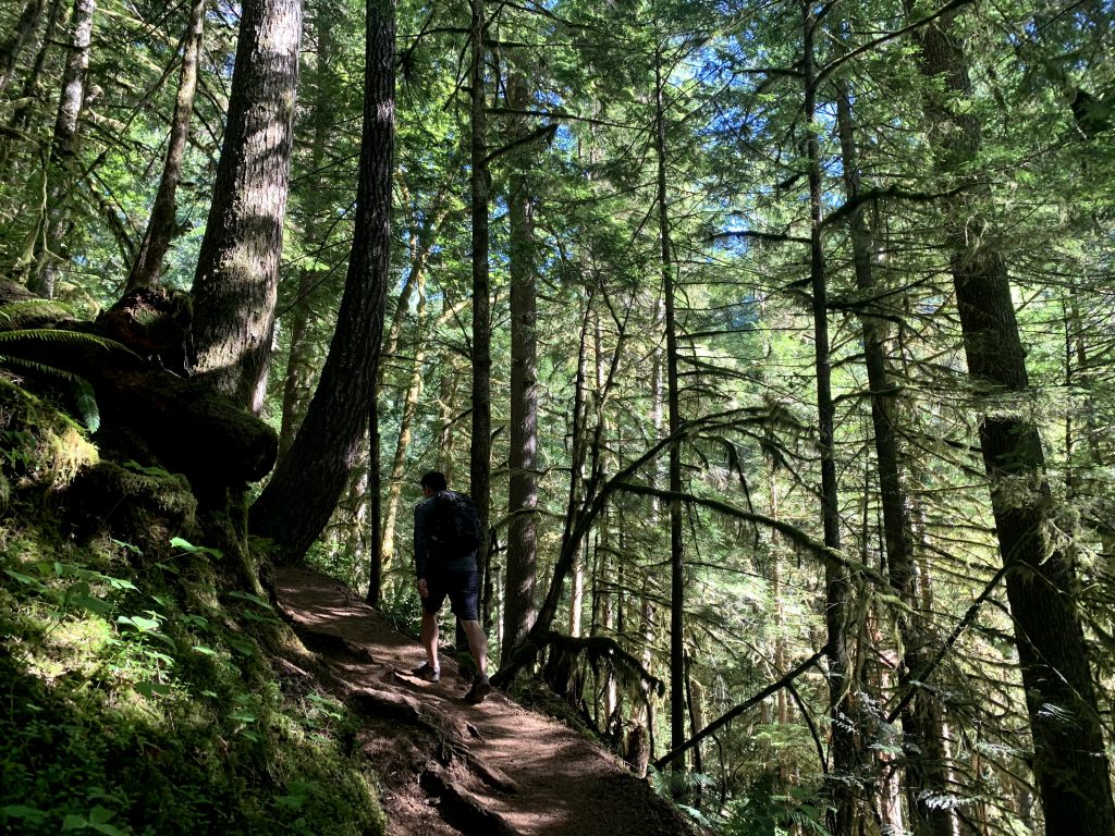
Mount Storm King Trail is a highly rated, highly difficult trail. It’s basically a hike straight up a mountain and straight back down the way you came. It’s 2000 feet of elevation gain in a round trip of 5.3 miles. The hike is mostly on a dirt path through a heavily forested mountain. At the top, there is a sign that says “End of maintained trail”. We got here in 1 hour. Do know that the view from this particular spot is ultra disappointing for all the effort it takes to get here. At this point, hikers have the option to go back down the way they came or continued to the very top.
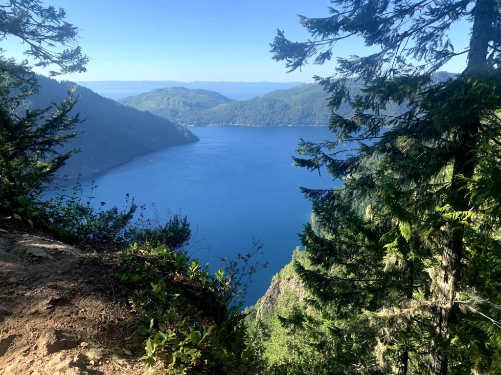
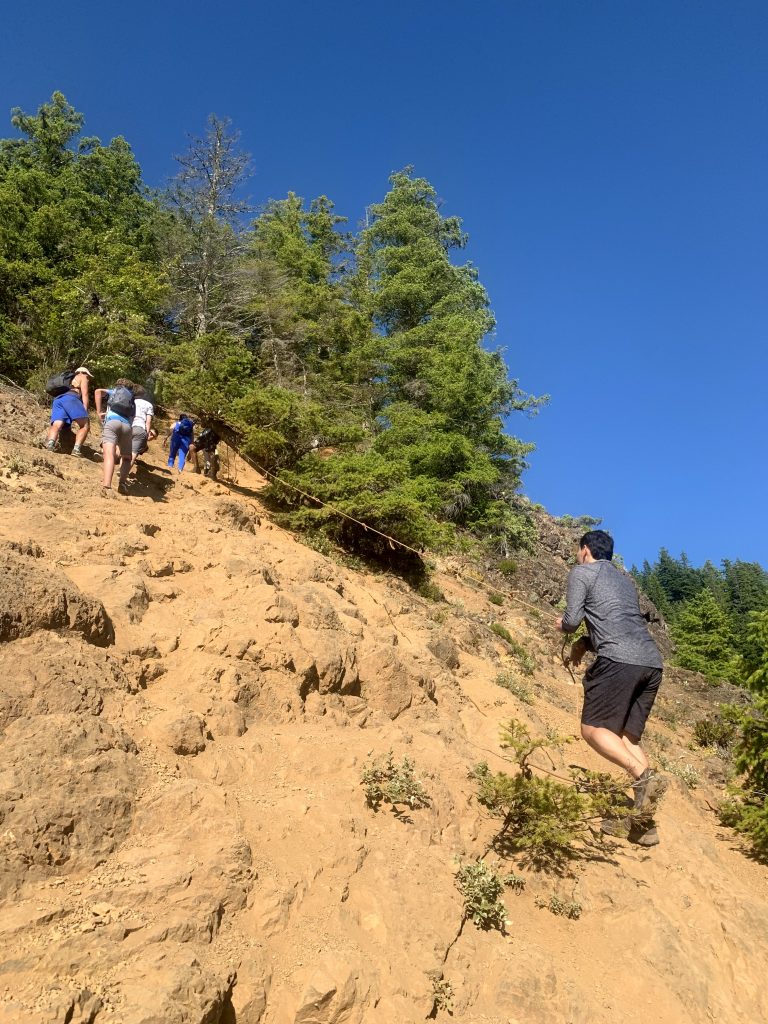
If continuing, there is a series of ropes that hikers have to hold on to as they climb the very steep, slippery dirt slopes.The whole thing feels super sketchy. The last bit is a walk over a narrow rocky top to get to the end with beautiful views of Crescent Lake down below. We believe the view here made the hike worth our effort, but if you are afraid of heights we would definitely not recommend going up the unmaintained path.
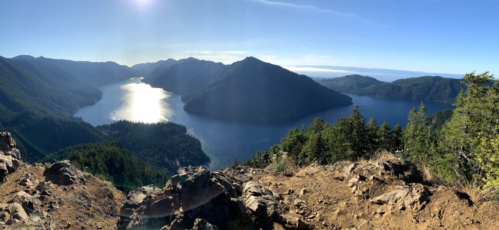
By the way, this hike was confusing for us to find. It didn’t even show up on Google Maps. Get to this trail by parking in the Marymere Falls parking lot and follow the Marymere Falls Trail. After 0.8 mi, you will see a sign for the Storm King Trail on your left, where it essentially starts going straight up the mountain, a big contrast to the nice flat trail you’ve been walking. That stark difference is how you know you found the trail.
6:50pm – Marymere Falls Trail (1.7 mi, 298 ft elevation gain, out & back, though we didn’t complete the loop)
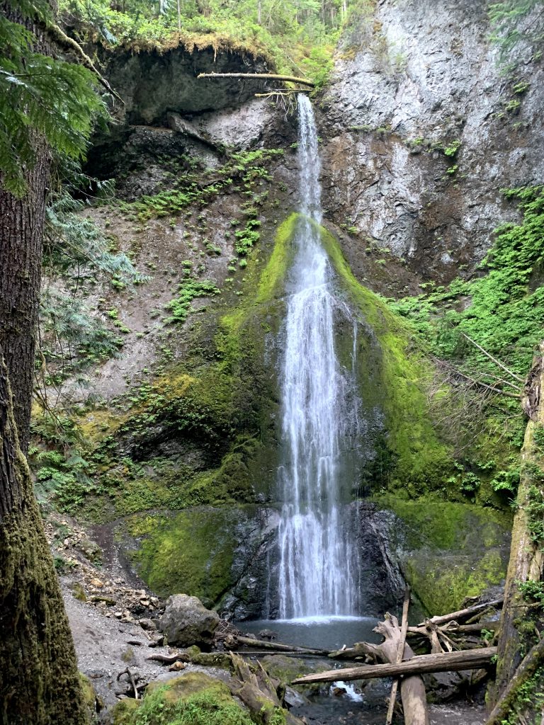
Upon finishing Mount Storm King Trail, we arrived back at the fork in the road to Marymere Falls Trail which we continued on to check out the falls. It didn’t take long before we arrived. While not a very big waterfall, it was graceful and unique in how the tiny source of water trickles down the rough side of the mountain. This is one of the more popular attractions of the park and not difficult to get to either. While we could have continued the loop, which takes you to the top of the waterfall for a different view of it, we were tired and did not feel the view from the top was worth the additional energy. The whole Loop would have been 1.7 miles but we decided to just turn back after enjoying the waterfall.
9:00pm – Sol Duc Campgrounds
After more driving from Marymere Falls Trail, we arrived at our campground for the night.
Day 2 – Sunday
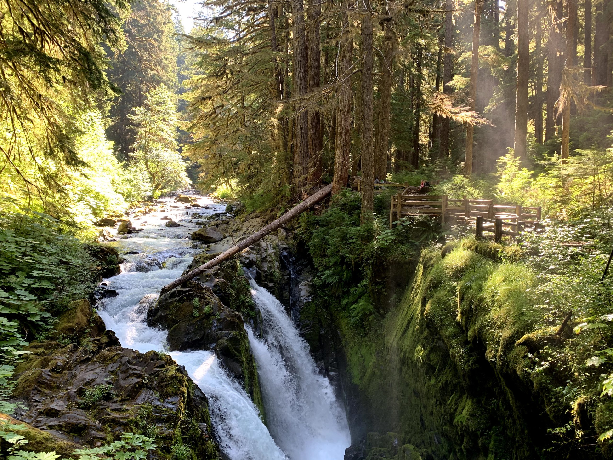
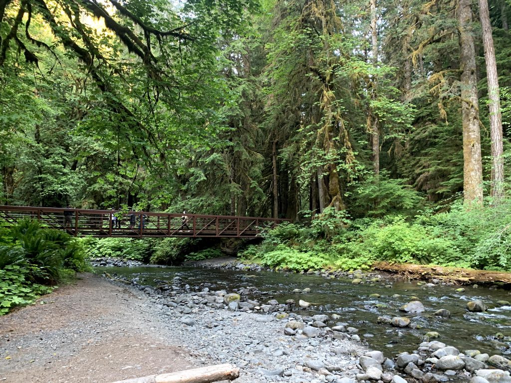
9:45am – 10:45am – Sol Duc Falls Trail (1.6 mi, 200 ft elevation gain, out & back)

I highly recommend hiking to see Sol Duc Falls. The waterfall is very picturesque, and the short hike is very family friendly, as we saw plenty of young kids with their parents on this hike. There is a wooden bridge at the end of the hike, across from the waterfalls, where you can take a lot of pretty pictures. The misty falls created an environment where it is easy to see the sunlight filtering through the trees and even a small rainbow.
11:00am – 11:25am – Ancient Groves Trail (0.5 mi roundtrip, flat)
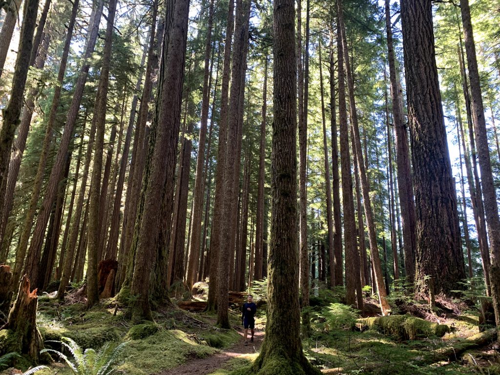
This hike does not get as much attention as it deserves. It is a short 1/2 mile hike through some really really tall trees. The payoff for the low amount of time and effort it takes is great. There isn’t even a proper parking lot for this hike; there is a small pull off on the side of the road to fit a couple cars at a time. But you should definitely make the stop, especially if you’re in the mood for a lazy stroll. Spend a half hour to walk amongst these ancient groves.
12:45pm – Rialto Beach
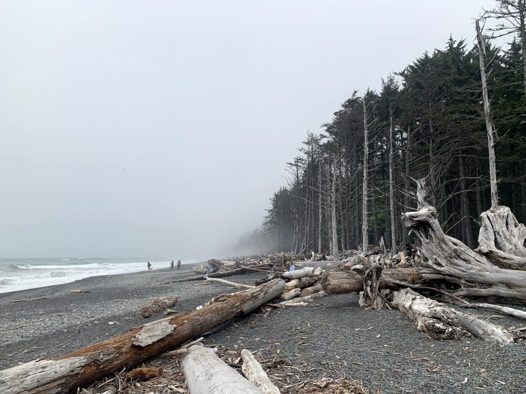
Rialto Beach is not like your typical LA beaches. It’s interesting because of its sea stacks, basically tall rocks out in the water. The sand is black and rocky the farther you get from the shore. There are lots of downed dead trees, which sounds off-putting but added to the uniqueness of this beach. When we went, it was incredibly foggy, which made the sea stacks almost impossible to see. The view was much nicer when the sun came out a few hours later. The area has bathrooms and a few picnic tables although you cannot see the beach from the picnic tables.
2:30pm – 4:00pm – Hike on the beach to the Hole in the Wall
The Hole in the Wall is an Instagrammable attraction you can hike to from Rialto Beach. More specifically, it is a sea stack with a hole that you can walk through when the tide is low. To get there, you have to hike 1.5 miles north along the coast of the beach. Because you’re hiking on the beach, it is wise to check the tide schedule before heading out. We went when the tide was receding, starting from 5.5ft to 4.5ft by the time we got back. It wasn’t low tide so we couldn’t walk through the hole in the wall, but it was good enough for me to feel safe the entire time. Remember that the hike is on a sandy and rocky beach, so it’s tiresome to walk. We had to jump on a downed log at one point to make sure the waves didn’t get us. But the sea stacks at the hole in the wall were closer and more fun to look at than the ones you could see at Rialto Beach without hiking.
4:00pm – 5:15pm – Drive to Hoh Rainforest
The Hoh Rainforest is a little over an hour drive from Rialto Beach. It’s not a difficult drive, but it is annoying that you have to go off the main highway quite a ways to see this one destination then have to go all the way back to the main highway where you came. The Hoh Rainforest is a temperate rainforest, which looked different than what I imagined. I think we tend to think of subtropical rainforests when we say “rainforest.” The Hoh Visitor Center is located here and there are few trails starting from this same parking lot.
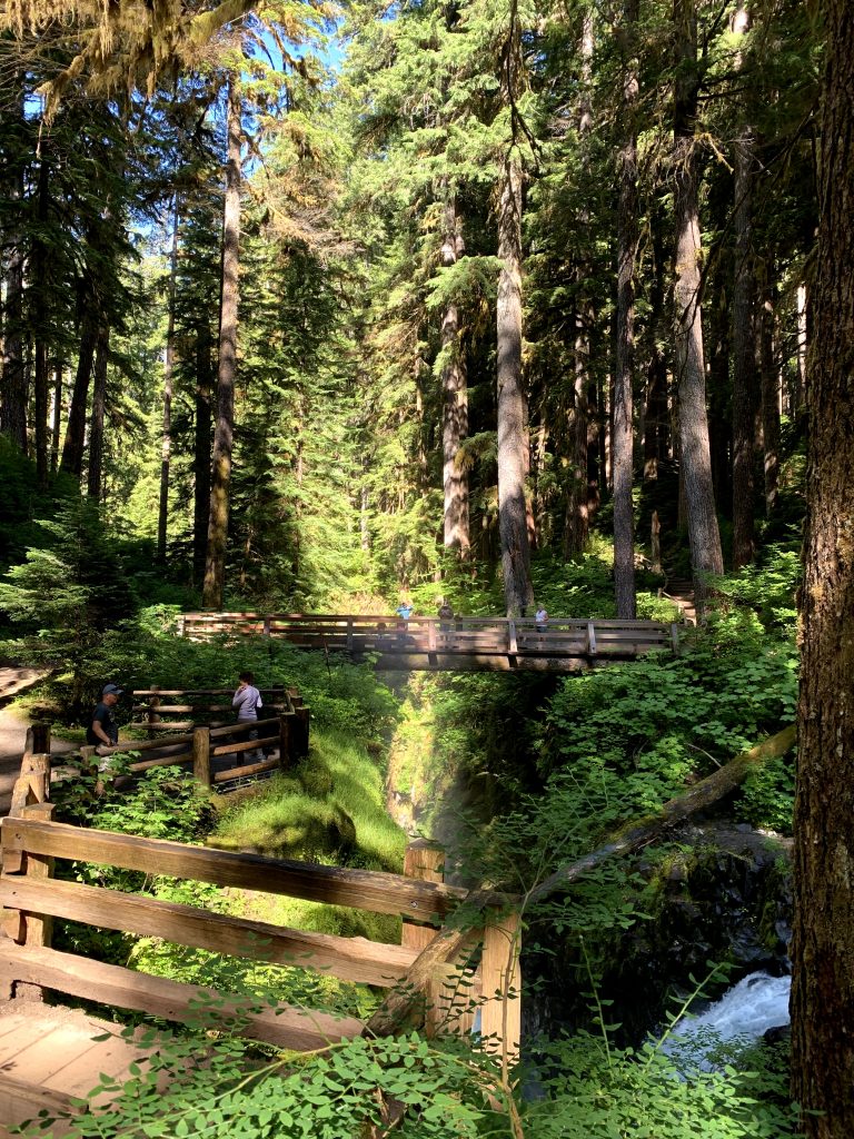
5:15pm – 6:30pm – Hall of Mosses Trail and Spruce Nature Trail
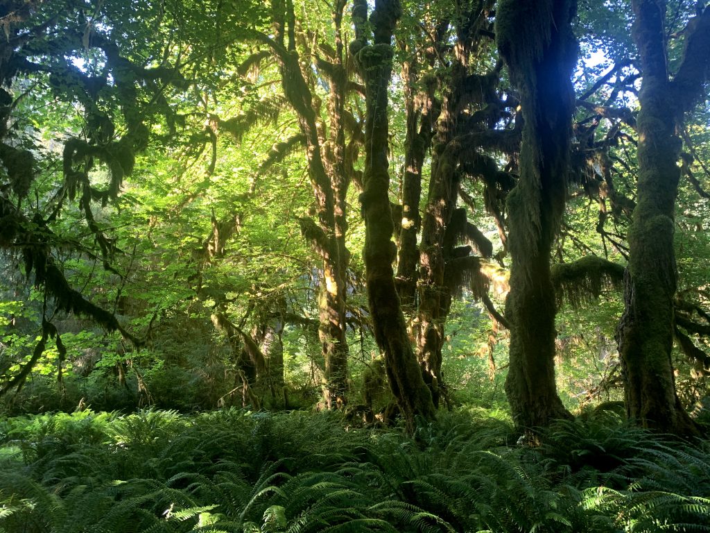
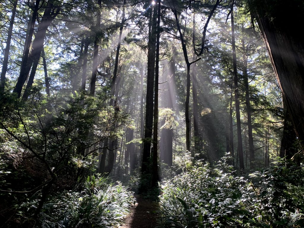
We hiked two short trails in the Hoh Rainforest area: the Hall of Mosses Trail and the Spruce Nature Trail. Both are easy to do and have short interpretive signs of the nature you see along the way. It is warmer here than the beach where we came from and there were many more bugs too. Mosses hanging off trees were a unique sight to see.
7:30pm – Kalaloch Campgrounds
After more driving we arrived at our next campground. Like I said, this park requires a lot of driving!
Day 3 – Monday
9:45am – Kalaloch Creek Nature Trail (1.4mi, 13ft elevation gain, out & back trail)
This hike has much of the same forested scenery as many of the other hikes we’ve been on. Although it is nothing too unique, it is a totally flat and relaxing stroll. It seems not as well-known as other trails so we enjoyed having the whole trail to ourselves. The trailhead was hard to find, so here’s a tip: it is located in Kalaloch Campground by campsite A54. There is no parking right by the trailhead but you can use the campground’s parking lot nearby.
10:30am – Take pictures of the Tree of Life
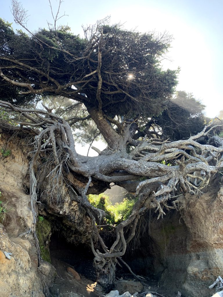
The Tree of Life is another Instagrammable spot right by the Kalaloch Campground parking lot. Follow the signs for “beach access” and once on the beach, walk 300 feet to the right. You will see a tree whose roots are suspended seemingly in midair. It is quite a cool sight! The beach it sits above is also pretty nice, with soft fluffy sand, much open area and few visitors. But we didn’t stay long because we wanted to go check out the next beach which I read more about.
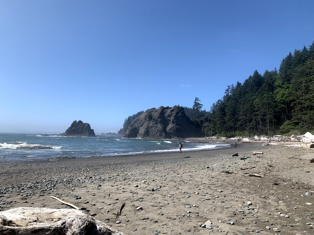
11:00am – Ruby Beach
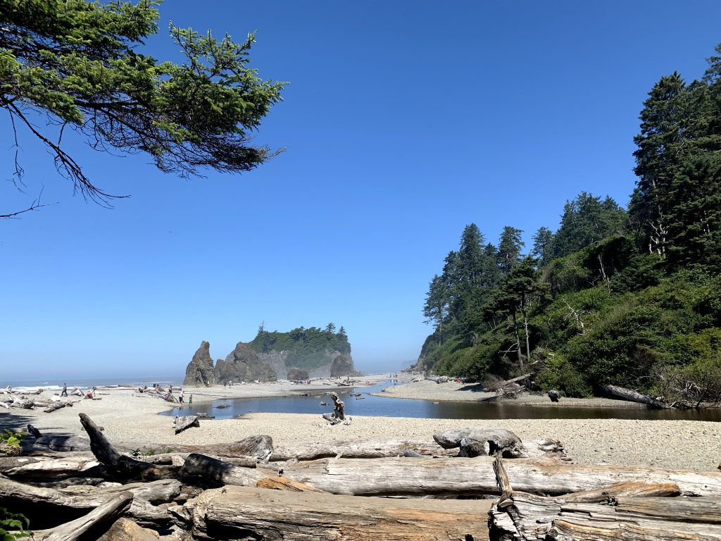
Ruby Beach is the one to go to for the more typical fun in the sun beach vibes. There are lots of groups just hanging out, skipping stones, or playing in the pond that accumulated on this sand. Maybe I was biased because it was a clear day compared to the gray day we had at Rialto Beach, but I enjoyed the more cheerful atmosphere here. We’re not the type to relax on the beach during our tightly scheduled trips but we sat on a log and ate snacks here.
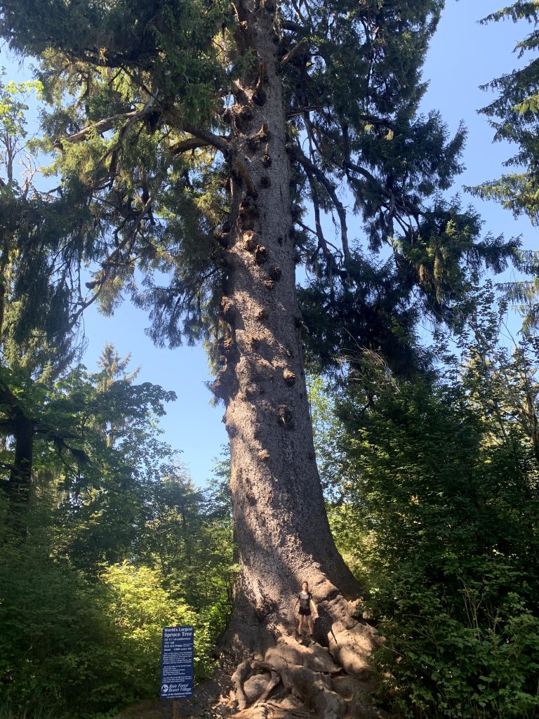
1:45pm Quinault Lake / Quinault Rainforest, and world’s largest spruce true
On the way Back to Seattle from Kalaloch Campground, you will be passing theQuinault Lake and Quinault Rainforest. For us, we decided we might as well check it out. Note that this area is not part of the National Park and you’ll have to pay a separate $5 fee to park. We decided to hike the Quinault Rainforest nature trail because it is short and easy. The rainforest looked much like what we had seen already.
While there are more hikes in the area, we decided we had done enough hiking and there wasn’t much more we wanted to see. Another option is to drive around the lake but we decided not to do that either. But we did make a stop to see the world’s largest spruce tree. It’s about a thousand years old, 58 ft in circumference, and one of six champion trees in the Quinnault Valley, with a whopping 922 AFA (American Forest Association) Points, whatever that means. I think it’s cool that there’s some association out there taking their time to scientifically decide which tree is the best of all the trees. Hehe, gives me a chuckle.