September 3rd – 7th, 2020
North Cascades is one of three national parks in Washington state. Aside from a beautiful turquoise blue lake, this park is all about the mountains, nothing but mountains. And all the many mile long, tough hikes on those mountains… but what a work out you’ll get! And oh the majestic views you’ll see along the way. We camped for 4 nights and spent 3.5 days exploring the park.
Day 1 – Friday
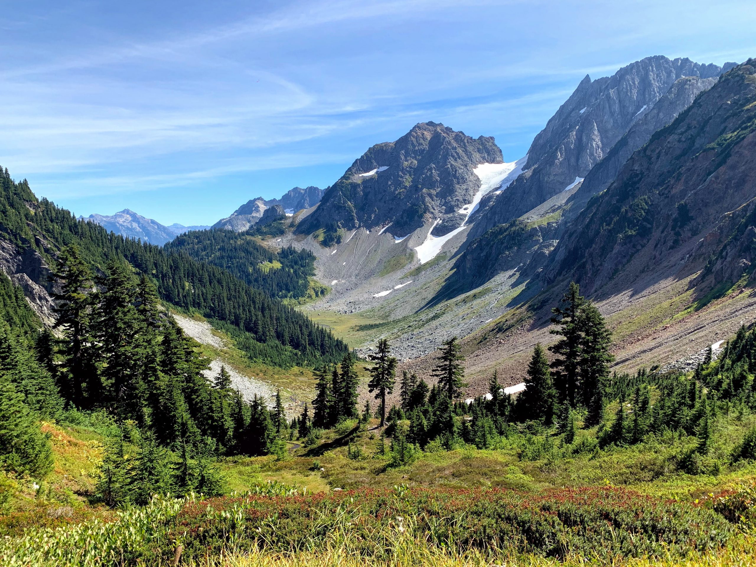
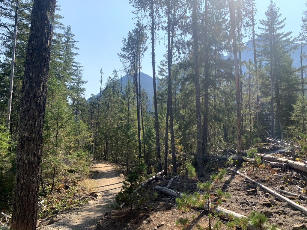
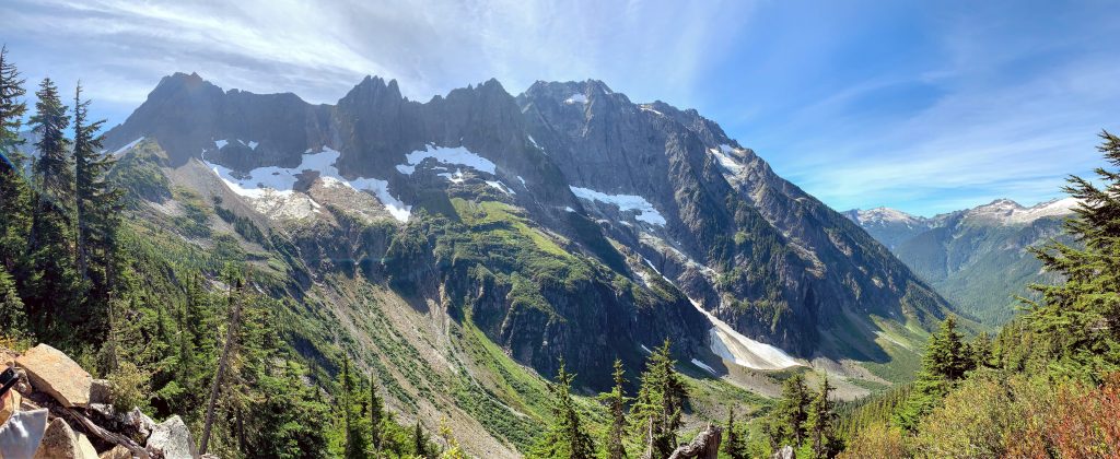
11:15am – 4:15pm – Maple Pass Loop
Maple Pass Loop is said to be one of the best hikes in Washington. We measured the hike to be 9mi long, and it took us a little under 5 hours, which includes the side trail to Lake Ann, but not the side trail to Rainy Lake. It is up to personal preference whether you should take a clockwise or counter-clockwise direction. Going counter-clockwise, the benefit is a longer, more gradual ascent, facing nicer views for more of the hike; the drawback is that the descent on the way back is very steep and can be hard on the knees. Those who choose to go clockwise do it to get the steep ascent out of the way first, then take a gradual descent down the majority of the way.
We chose to go counter-clockwise. From the parking lot, follow the sign that says “Lake Trail”. The first section is 1.3 mi to a sign that says Lake Ann. It’s another 0.5mi to get to the lake then you have to head back. I don’t think the lake was worth the stop so I wouldn’t recommend it, but I guess you could do it since it’s not difficult and doesn’t add too much distance. After here, it started getting much harder the higher we climbed. Most of the hike just climbs the ridge that surrounds the lake. Before reaching the top, we found a spot on the side to eat lunch. Even though the ground was too rocky to sit on, I wanted the break. The last stretch before the top felt like a long time, and I kept thinking we were almost there just to find there was more to hike. At the top, you can see the entire lake below and just how high up you climbed from the lake’s shores! Once ready to head back down, take the steep descent on the other side of the ridge. There’s not much to see during the descent.
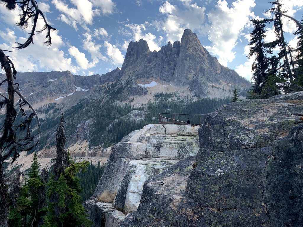
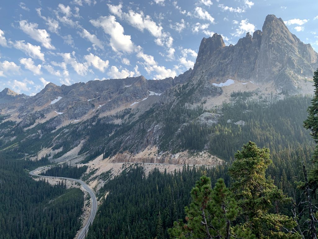
6:00pm – 6:30pm Washington Pass Overlook
7:00pm Ross Lake Overlook
This is just a quick pull out spot from Highway 20 that fits three or four cars; that’s it, no bathrooms or anything. We stopped here because it was on the way back, but it wasn’t any more special than a normal pull out spot, so I’m not sure why this one has a name. If visiting at all, you’ll probably spend 5min here at most.
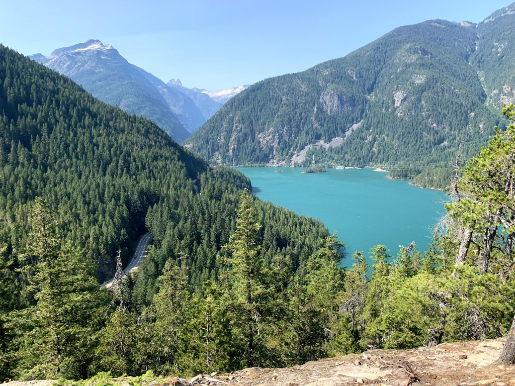
7:15pm – Diablo Lake Overlook
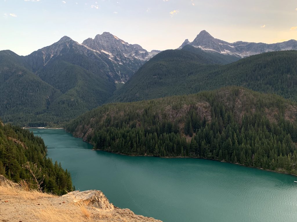
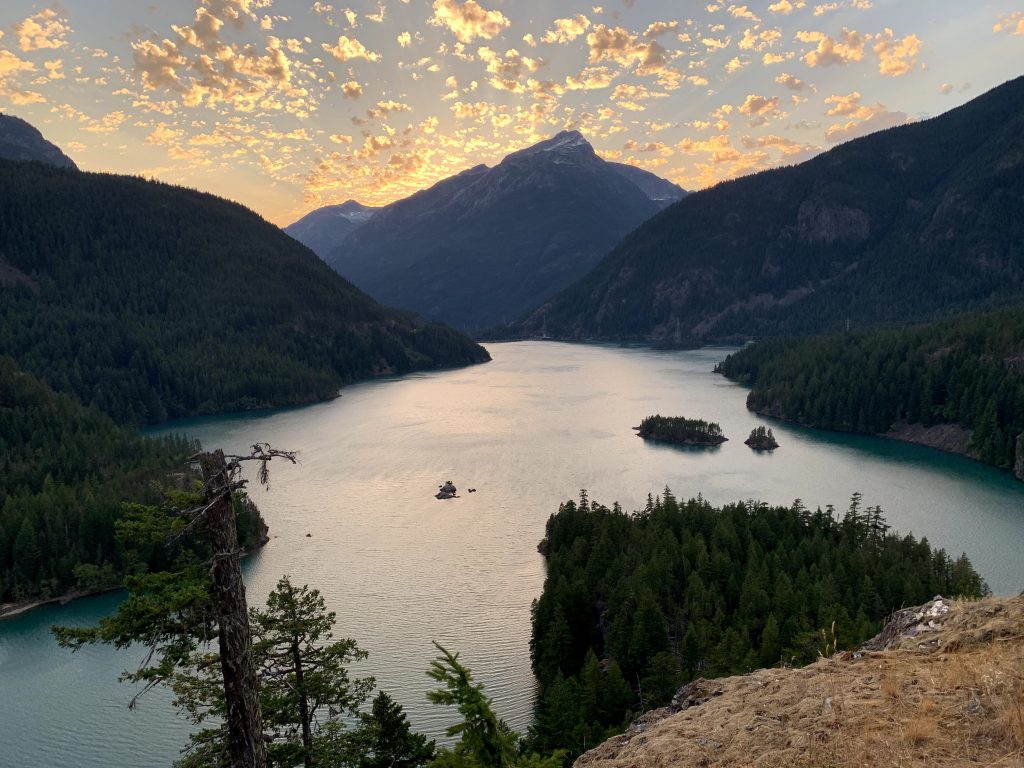
Definitely a highlight of the park! The turquoise waters of Diablo Lake are just so incredibly pretty. This photogenic spot looked great when we went at sunset. The overlook itself is very well developed and large, with a big parking lot. It also has informational signs and picnic tables. The park clearly knows it’s a popular destination and put more resources into this area. Going at a leisurely pace, you could spend 20-30min here, but we were in a hurry to get to our campsite before dark, so we spent 10min here to take some quick pictures.
Day 2 – Saturday
10:30am – 12:00pm – Thunder Creek Trail
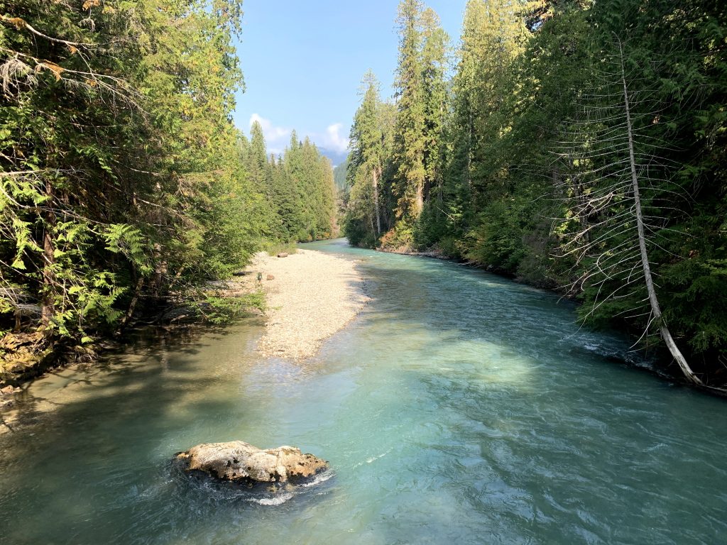
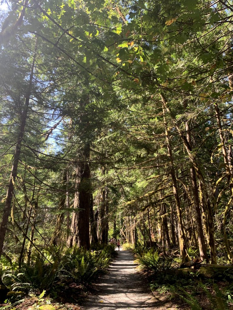
This trail is ~20mi long but many people just hike to the bridge 1.5mi in, stop to admire the view then hike back. And that’s what we did. It’s a relaxing and easy hike that follows the creek, with not much elevation gains. This section of the hike just goes through a forest so don’t expect any great views. But the enjoyment is being able to walk along the creek, with the highlight being the bridge right over the creek. There was a nice breeze that day that added to the peaceful, lighthearted atmosphere. This didn’t feel much like a hike, rather a pleasant stroll by the water. It adds some variety when the rest of the hikes in this park are all grueling long climbs up the mountains. I absolutely recommend it to anyone.
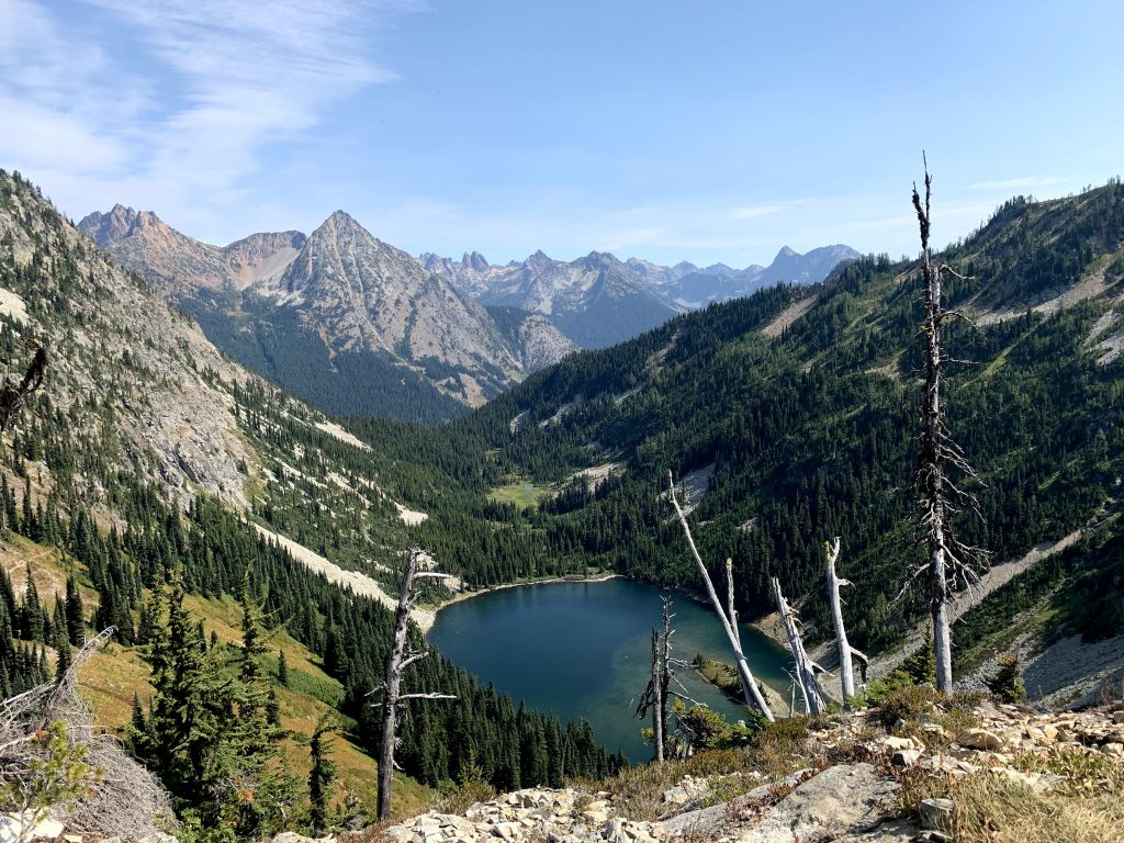
1:30pm – 3:15pm – Thunder Knob Trail
The whole hike is super boring, nothing to see the whole way but moderate elevation gain to make it not relaxing either. While the whole climb up I regretted doing this hike, the view at the top exceeded expectations. It looks down on Diablo Lake below, offering a different perspective from Diablo Lake overlook. The hike back down was much faster than going up. It was also the most crowded trail, by far, and we passed hikers every couple feet. Maybe because it was a Saturday on a three day weekend. The trailhead starts in North Colonial Creek Campground.
3:30pm – Chill at a picnic table on the dock, by the campground’s main parking area
There are two beach-like areas around the section where north meets south Colonial Creek Campground, one on the north side and one on the south side. The beach on the south is much more popular and several people were playing in the water. Aside from those two areas, there’s also a dock with a picnic table by the main parking lot. We chilled here for some time to take a break.
4:00pm – Diablo Dam
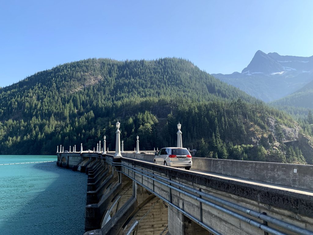
It’s worth a stop; however it is an incredibly narrow drive over the bridge to get to the parking lot. You could easily wait for cars going in the opposite direction to finish first before getting on, but if you’re unlucky, the cars in the opposite direction won’t wait for you to finish before getting on. On the other side, there are a few parking spots and you can get out and take pictures. Several others parked along the side of the road that continues on for a little ways. At the end of the little road, there is another little beach that we saw several families enjoying. Seeing this dam also added some variety to this trip. You could just as easily be entertained by watching the cars try to pass each other on the narrow bridge as seeing the dam itself.
5:00pm – Gorge Creek Overlook
There is a parking lot here, which makes it an easy stop. We parked and got out to walk on both sides of the bridge. There is a tiny waterfall on one side and Gorge Lake on the other. The view wasn’t too impressive but it was low effort. There is also a trail here but I read that it didn’t offer much so we skipped it.
5:30pm – 6:15pm – Ladder Creek Falls
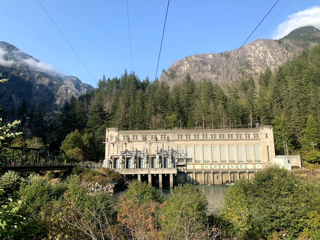
The falls are located behind Gorge Powerhouse. This power plant was built in the 1930s and ‘40s, and the small nature attractions surrounding it were developed because the owner wanted to showcase the area. I enjoyed the sunny, breezy walk over the suspension bridge to the plant, and how short a walk it is to get up to the falls. There is also a light show at the waterfall at night, but we did not go for it.
Day 3 – Sunday
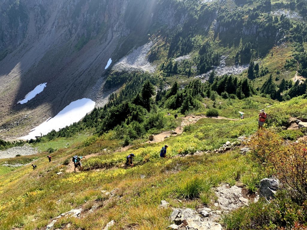
12:00pm – 1:45pm – Cascades Pass Trail / 1:45pm – 2:30pm – Chill at Cascades Pass at the top of the trail
Let me first tell you how unimaginably difficult it is to park here! The road leading to the trail is mostly gravel and very narrow. The way too small parking lot at the top fills up quickly, leaving cars to have to drive back down the mountain and find parking on both sides of the already narrow road to begin with. It also means many will have to walk quite a ways up the mountain, back to the parking lot first before beginning the hike. Now onto the hike itself!
The hike begins with a series of switchbacks through the dense forest. There are just so many switchbacks here to begin the trail! But with all the mental preparation I had going into this hike, I simply put one foot in front of the other and this section was actually doable for me. After finally coming out of the switchbacks and the thick forest, it transitions to more open views of the valley. As you hike, look around and you are reminded of all the mountains surrounding you for very far! At the end of this section, Cascade Pass is a perfect spot with a few rock benches to stop, rest, and enjoy the nice view. There is an outdoor toilet, unappealing in every way but there if you’re desperate. This is the perfect turnaround point for those who do not wish to continue to the glacier.
2:30pm – 7:30pm – Sahale path (from Cascades Pass viewpoint to Sahale glacier)
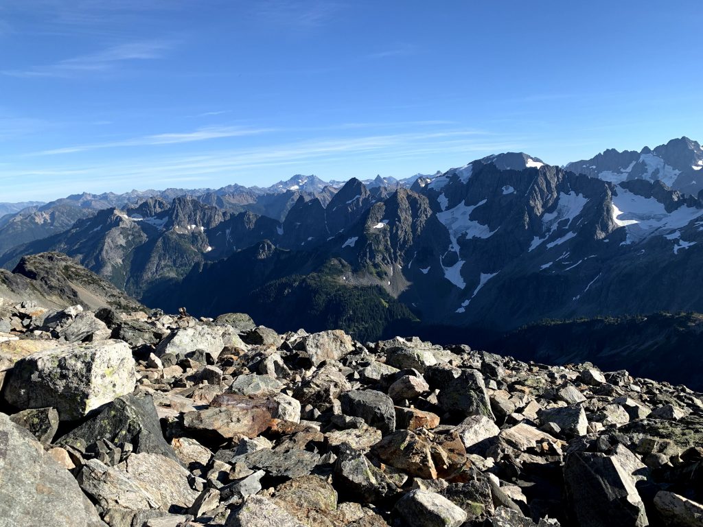
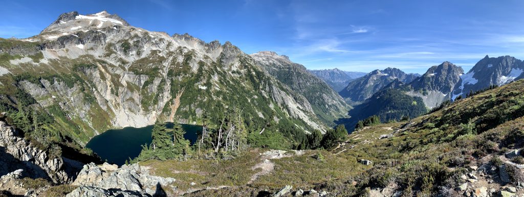
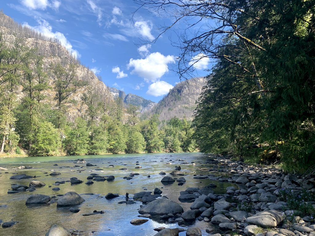
We continued on the Sahale path to Sahale glacier. After climbing 2,000ft to get to Cascade Pass, from here it’s another 2,000ft of elevation (yikes!). The beginning consisted of some real uphill climb through the meadow on the side of the mountain. I stopped every couple feet to frown at this stupid climb. At 1.5mi in, you reach a view of Doubtful Lake below. It’s a beautiful view with the valley in the background. We also saw a mountain goat around here. Then more hiking, hiking, asking someone on the path how far it is from here, and her telling us yeah, see that tiny person up there? That’s where you’re going so there’s still quite a ways. 🙁
The last section of the hike is scrambling over rocks, with no real path. It gets very windy and more and more chilly the higher up you go. Perhaps 400ft from the top, I gave up because I didn’t want to climb over rocks anymore and I was afraid of running out of day light. Boyfriend was able to make it all the way to step on the glacier. We were one of the last ones to leave the mountain, no exaggeration, not a good feeling. We set an aggressive pace all the way down. It was one of the few times going down the switchbacks felt longer than climbing up, wondering when were we going to reach the bottom. But we made it by sundown! I liked this hike better than Maple Pass Loop, but man did the whole thing take some effort.
Day 4 – Monday
10:45am – Sterling Monroe Viewpoint
This viewpoint is right next to the visitor center. It’s a very short walk on the boardwalk, but also to a very meh view. Since we did it at the end of the trip, it just couldn’t compare to all the better views we’ve seen already.
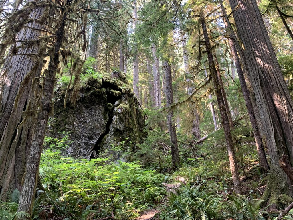
11:15am – 12pm – Trail of the Cedars
This is a short 0.3mi nature trail through a dense forest, with interpretive signs along the way. It’s flat and peaceful, with access to the water— highly recommend! The informative signs were done well. Parking is in a lot across the road from Main Street. Cross a sidewalk, follow Main Street, then start at The Suspension Bridge to Trail of the Cedars. You could get away with parking on Main Street if you get back in 30min, but you may feel rushed. There are several picnic tables by the parking lot and by Main Street. After a very windy ramen lunch on one of those tables, it was time to go home!
A note about campsites!
The two we stayed at were Colonial Creek Campground and Newhalem Campground. These are the only two with flush toilets, making them the best campgrounds in the park, as far as I’m concerned. Both were lovely and can be reserved on recreation.gov (not North Colonial Creek which is first come first served, but South Colonial Creek). There are no showers, but I don’t recall any campgrounds in this park with showers.