(Saturday August 1st – Monday August 3rd, 2020)
The proximity of this park to Seattle makes Mt. Rainier a popular and easily accessible destination. Mt. Rainier is of course the highlight, but I also enjoyed the wildflowers late summer and marmot sightings here. It’s a relatively condensed park as there are only two main areas, Sunrise and Paradise, which makes it easy to see everything without too much driving.
Day 1 – Saturday
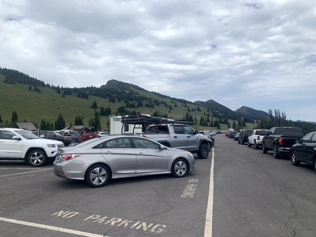
12:00pm – Sit in traffic for 1hr 45min waiting to get into the park
During covid, every day is a crowded day. Everyone is just desperate to go outside.
1:45pm – Sunrise Visitor Center
We finally arrived! It was tough to find parking and many cars were parked in illegitimate spots, but we too made it work. Again due to covid, we could only ask rangers questions outside the visitor center.
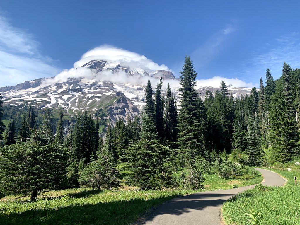
2:15pm – 3:15pm – Silver Forest Trail (1.9mi, 200ft elevation gain, out & back)
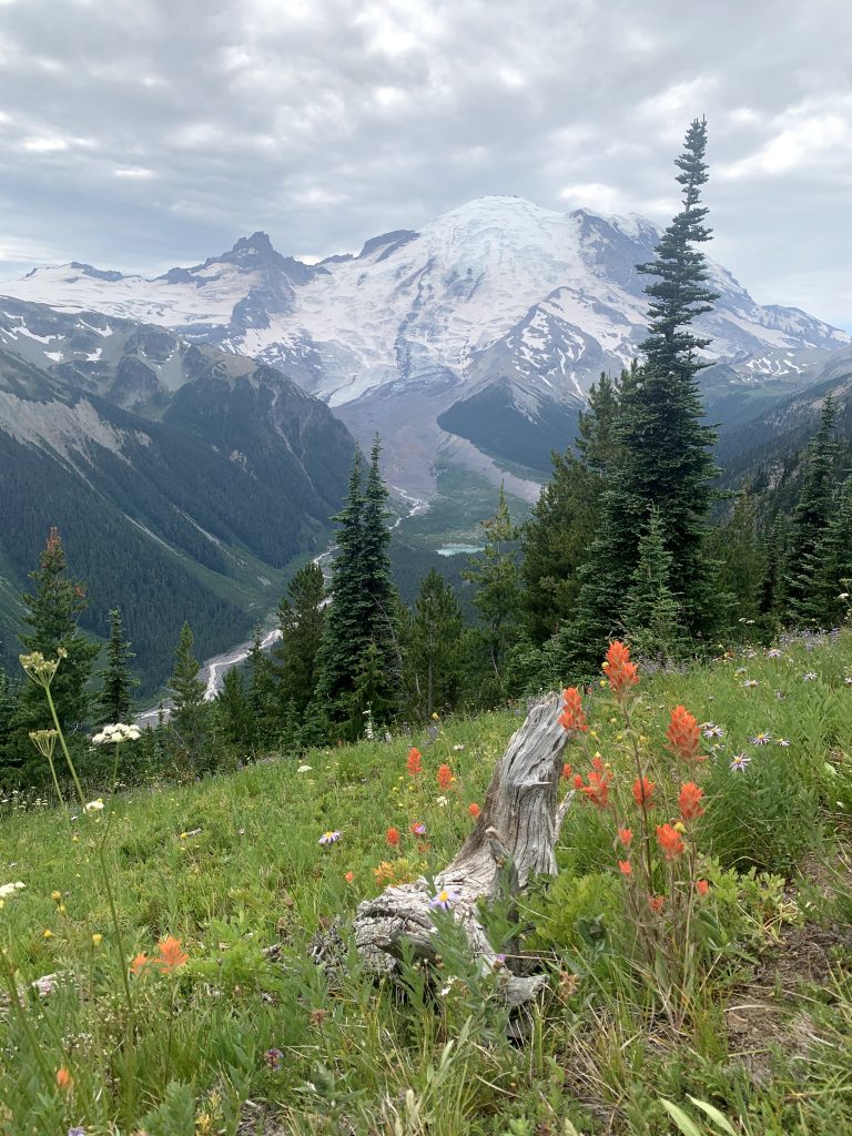
There are two vantage points of rainier and its glaciers right at the beginning. The hike continues on a dirt path through the meadows on the side of a mountain. The highlight of going in early August is the abundance of wildflowers all along the trail. Mt. Rainier is visible throughout the hike, but it serves as more of a backdrop, and not the object of your focus while hiking. The whole trail is flat and easy. It’s also the same kind of experience the entire trail; you’ll get a taste of it in the first 20min and the rest of the trail will not change much. Also, you’re not walking to any kind of special destination; when you reach the end, there’s just a small sign in the road like some guy arbitrarily just decided cool, this is the end of it.
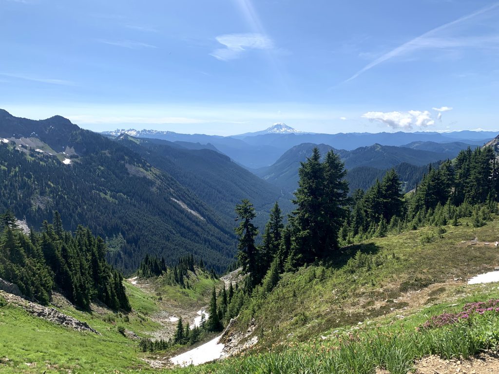
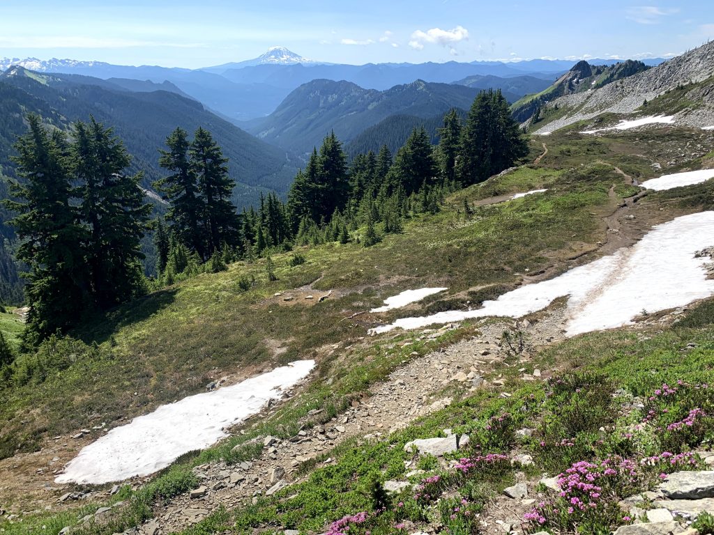
3:30pm – 7:15pm – 2nd hike. Start at the visitor center, go to Glacier Overlook, Frozen Lake, Sourdough Ridge, back to Sunrise Visitor Center
There are a number of different paths you could take from this visitor center, as you can see from the map. We chose a moderate loop that took us past a couple different sights.
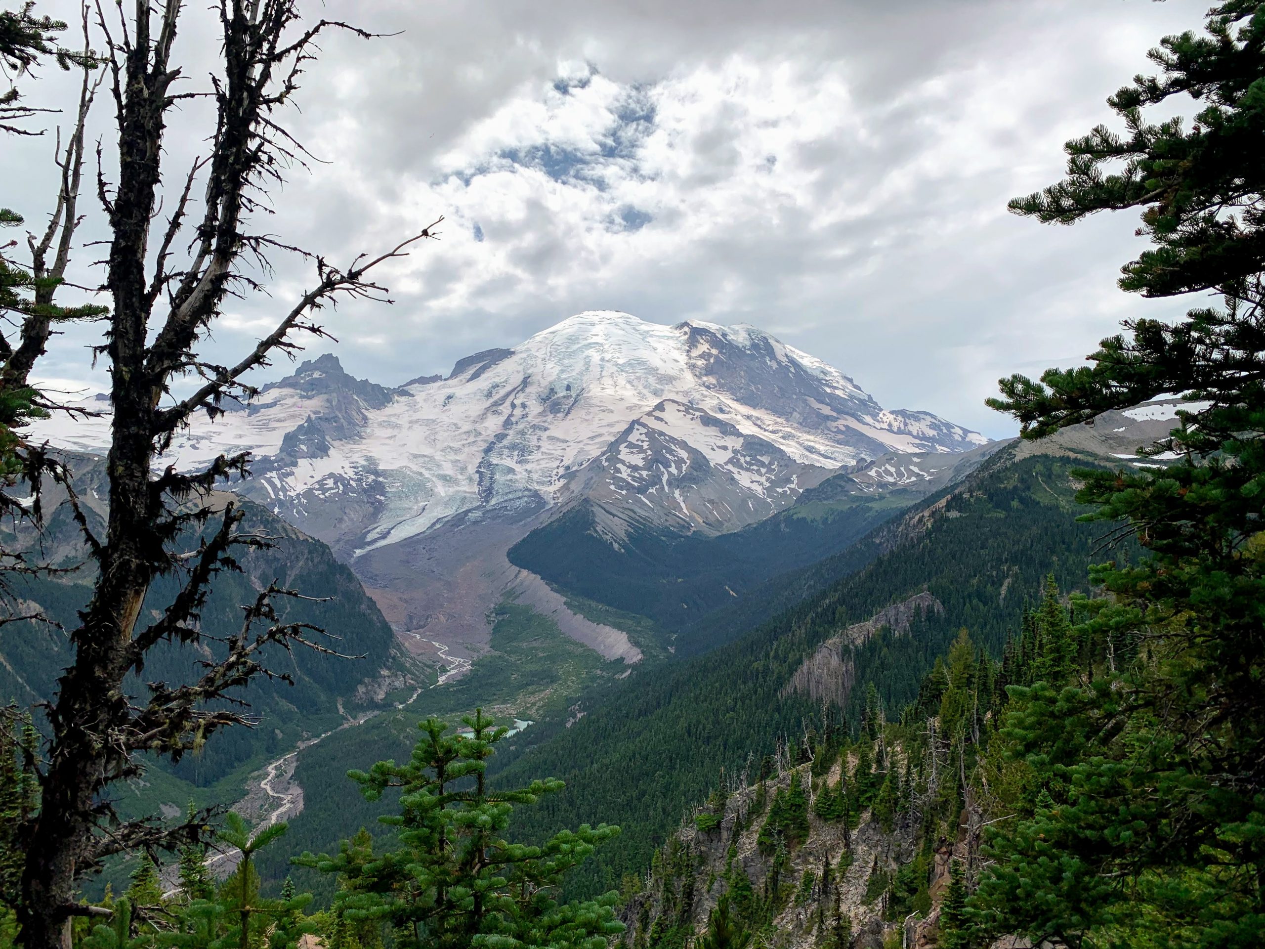
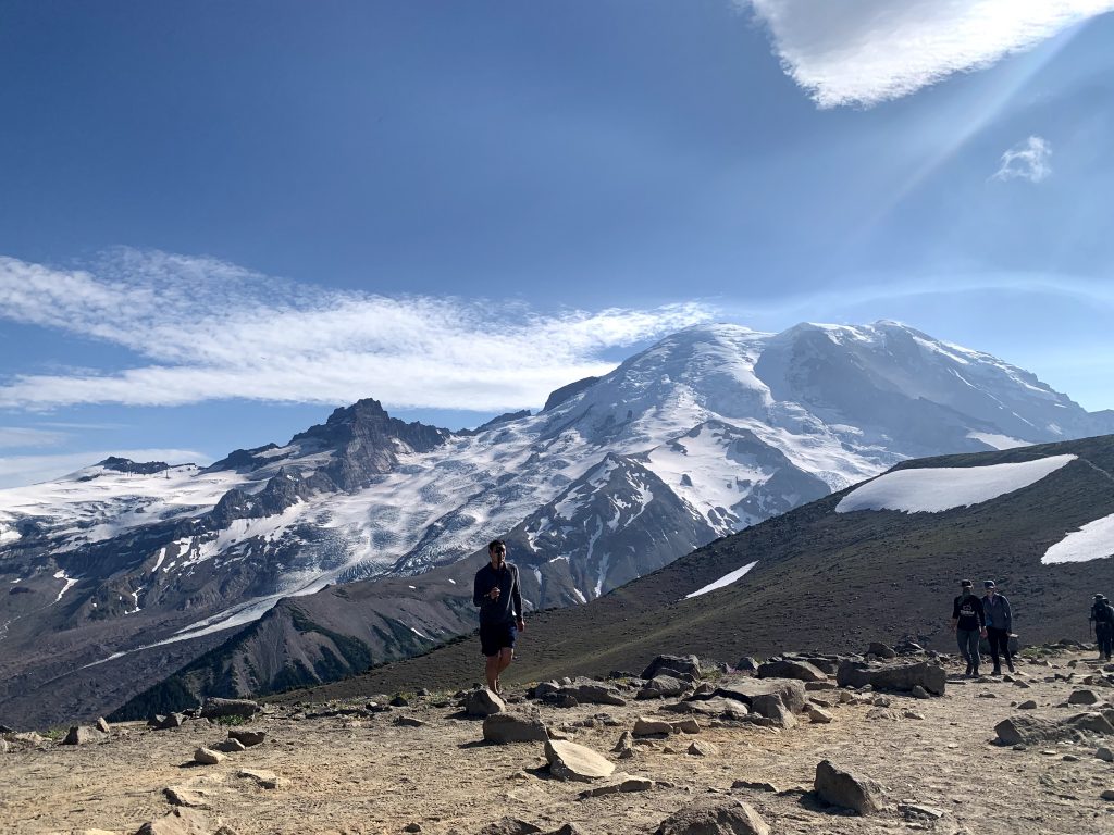
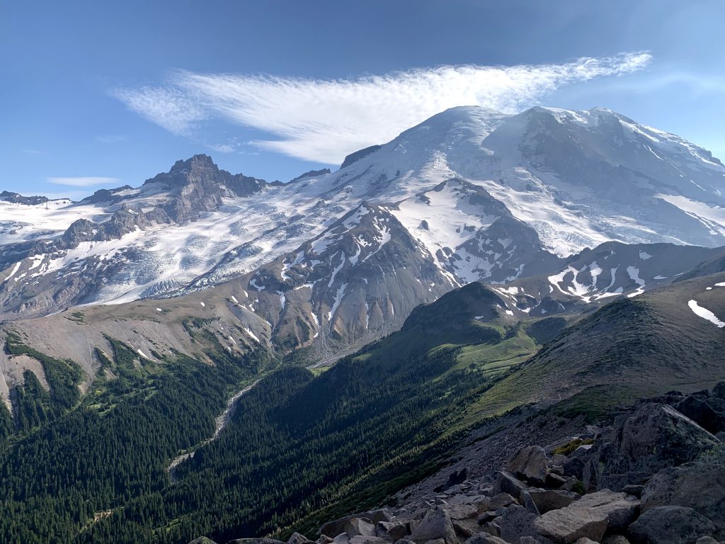
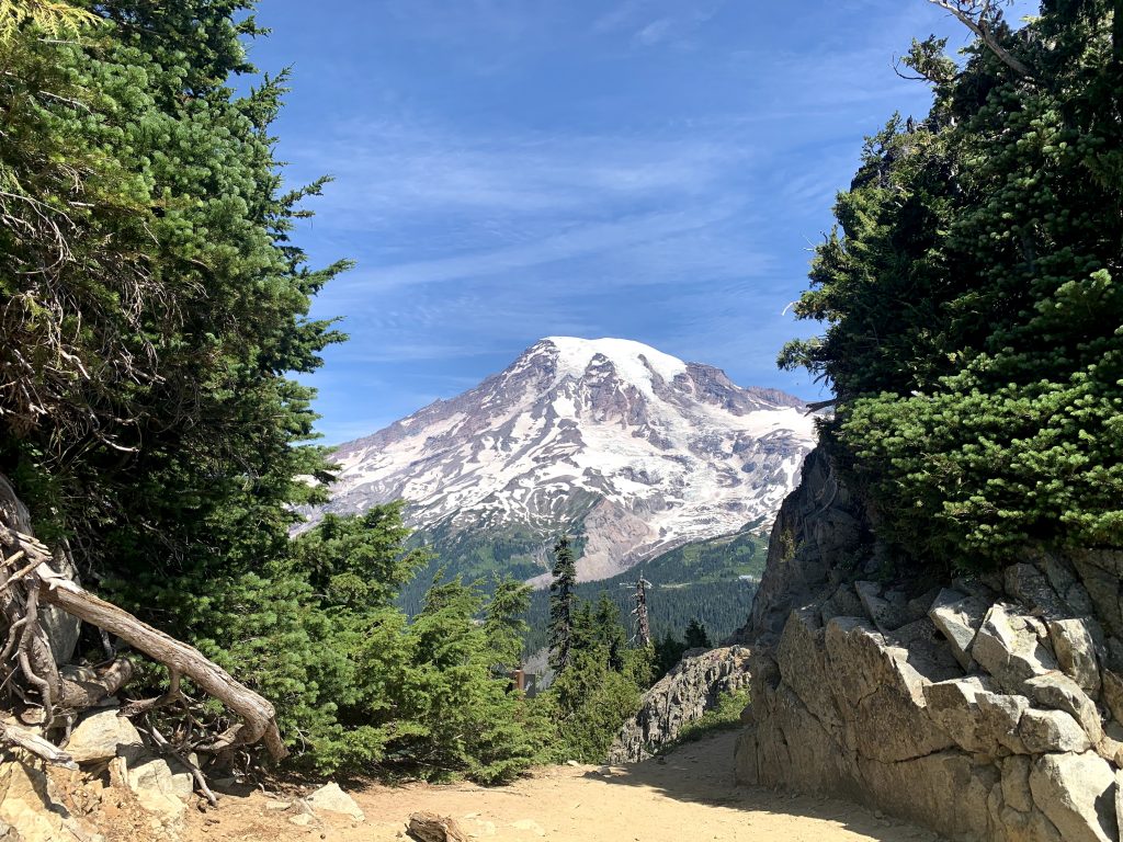
From the visitor center, there is lots of uphill to Glacier Overlook. You pass Shadow Lake but it’s pretty lame. At Glacier Overlook, you can sit and enjoy the awesome view. At this spot, Mt. Rainier is massive, close, and unobstructed. You can see a small intensely blue lake from up here.
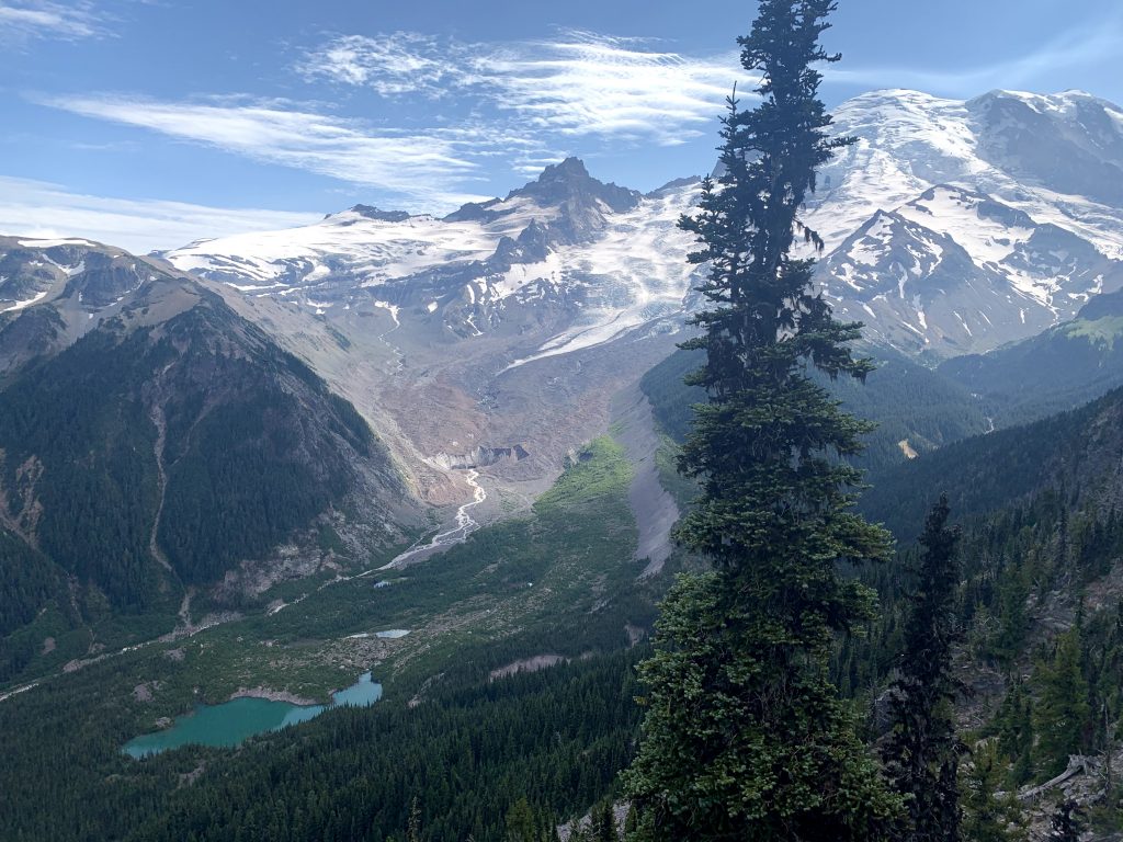
Continue very uphill again to Burroughs Mountain. This area of the Alpine Tundra is similar to the Tundra zone of the Arctic regions of the world. It is dry, rocky, and holds onto what soil and vegetation it can. Upon reaching First Burroughs, you have a viewpoint of the surrounding area, one side being the valley, the other is Rainier. We decided to continue the 0.6 mi to get to Second Burroughs. This was a large area to get a much closer view of Mt. Rainier.

One view at First Burrows Another view at First Burrows
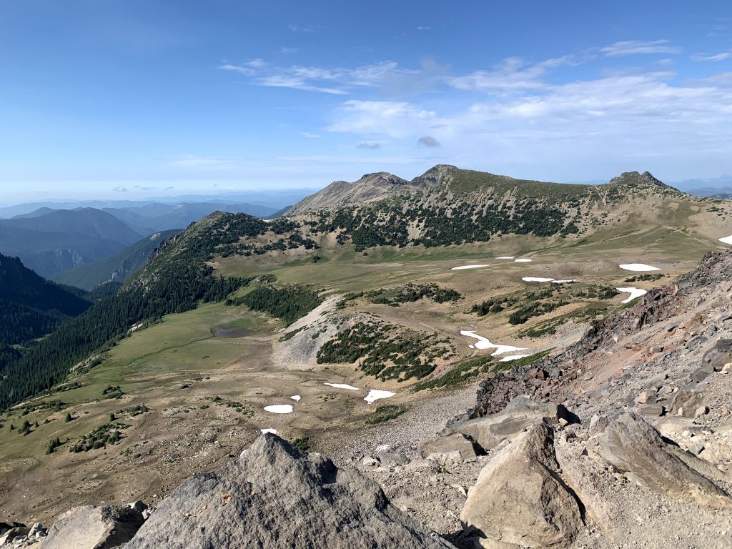
Head back to First Burroughs to continue the hike to Frozen Lake. The hike is much easier after the Burroughs. Frozen Lake wasn’t frozen when we went early August, but it did have a large patch of snow hanging around its edges. The last part of the hike is along Sourdough Ridge, back to the visitor center. It is a nice way to wind down from the tough hike, over mountains and trees with blurry outlines of many mountains far out in the distance.
8:00pm – Watch sunset at Tipsoo Lake
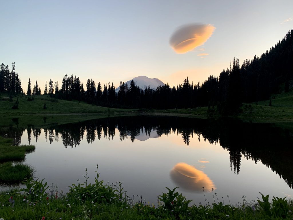
A prime spot for photography, it’s a short 10-15min walk from the parking lot to get to the other side of the lake, where there’ll be a bunch of tripods set up at sunset. Photographers love it for the symmetry of reflections in the lake.
Ohanapecosh Campgrounds
This was our campground for the first night. There are no showers, but flush toilets are available. We made reservations ahead of time on recreation.gov.
Day 2 – Sunday
10:30am – 1:30pm – Pinnacle Peak Trail (2.4mi, 1056ft elevation gain, out & back)
Park at Reflection Lakes for this trail. Pinnacle Peak Trail is just a bunch of uphill until you reach the end then come back down the way you came. It begins in the forest before emerging to follow along the side of the mountain. The path is a combination of dirt and/or rocks. Along the way, Mt. Rainier can be seen in the distance. I honestly don’t remember the details of getting to the end; it was a lot of heads down, just keep hiking.
The end of the maintained trail is a small dirt area, with views of a valley and an unidentified, far away mountain. Turning around to look at the path you just came from, you see Mt. Rainier once again. From the end of the maintained trail, you can turn left to try to scramble up to the peak, but it isn’t much of a trail and more of a scary scramble. We asked a couple who did it how it was, and the woman said she cried.
End of maintained trail – looking ahead End of maintained trail – looking back
We instead turned right to climb just a tad bit higher, where we sat on some rocks to eat our salad lunch. Here we saw a marmot bumble along. We then walked down a little bit to explore the meadows… and throw snowballs at each other. The freedom to choose our own adventures here made this part of the hike a little more memorable than the rest of the hike. We went back down the way we came.
1:45pm – Inspiration point
This is a pull off spot with a parking lot. We chilled here for a bit. You can see a valley in one direction and Mt. Rainier on the right of it.
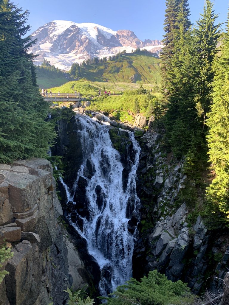
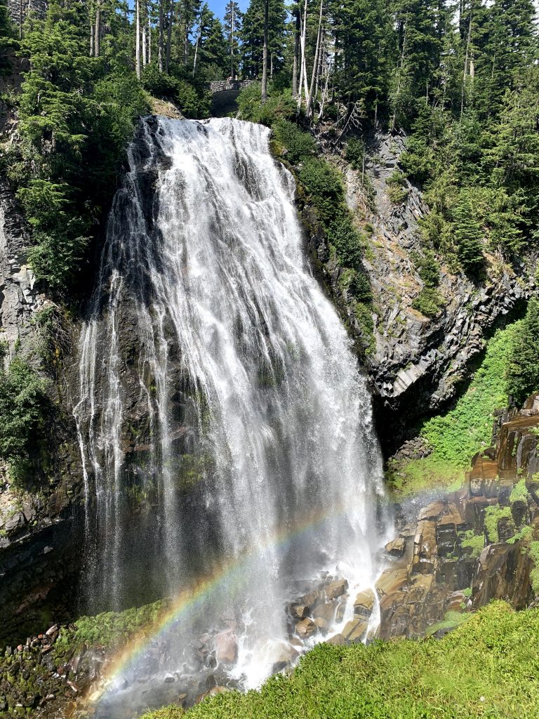
2:15pm – Narada Falls
High quality waterfall. Boyfriend, the self-proclaimed waterfall connoisseur approved. A view of the top of the falls can be seen from the parking lot but it doesn’t look impressive from up here. Walk a short path over a bridge then down a flight of steps and you can see the entire falls.
3:00pm – 3:30pm – Henry M Jackson Visitor Center
This visitor center is located in the area of the park called Paradise. This is another large visitor center with a good view of Rainier right next to it.
3:40pm – 4:15pm – Nisqually Vista Trail (1.1mi, 180ft elevation gain, loop)
Easy trail, stroller accessible in fact. It’s a hike through the trees and looking up, there’s a view of Rainier. Not the most impressive view or Rainier, but it’s a very good bang for your buck.
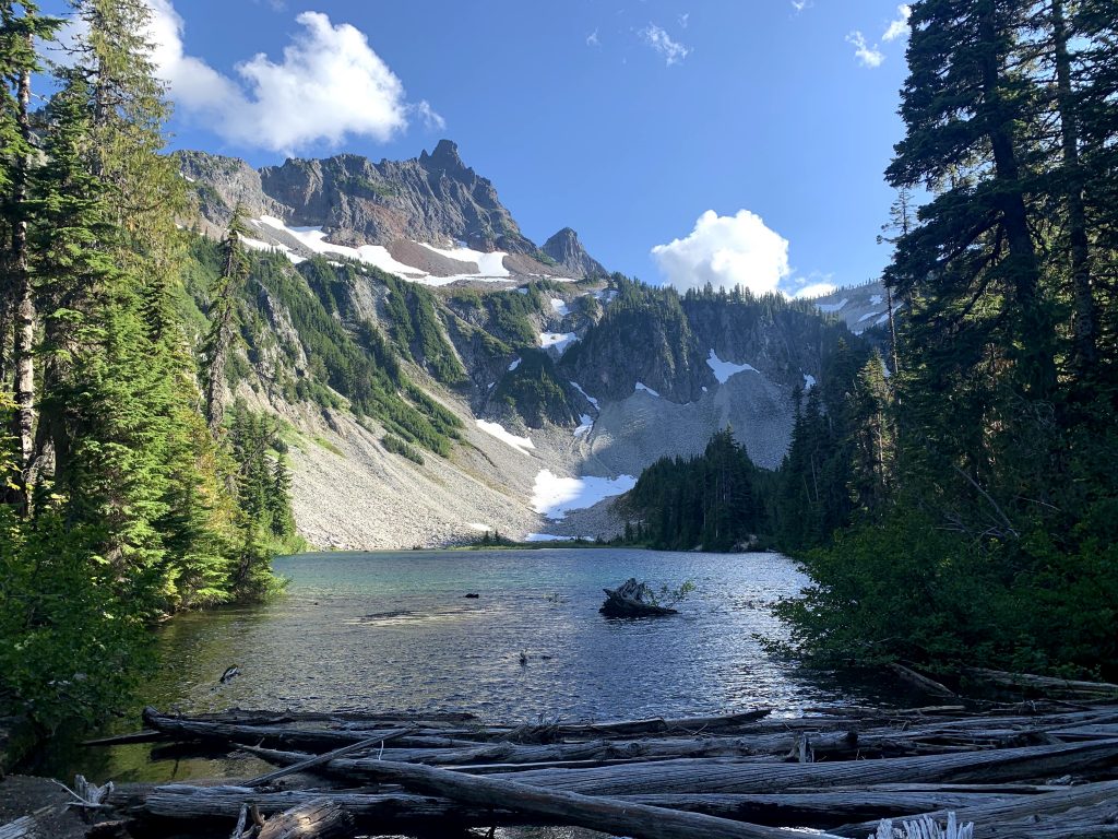
5:00pm – 6:45pm – Bench & Snow Lake Trail (2.5mi, 700ft elevation gain)
The emphasis of this hike isn’t Rainier; it’s the lakes. The path is a series of ups and downs. It’s .75mi to Bench Lake and another .5mi to Snow Lake. Here’s a tip: the trail will take you to a view of Snow Lake, but you should also follow the sign that says “Snow lake camp .1 mi” for a better view of the lake there. At Snow Lake, the background consists of random mountains. At Bench Lake, Rainier can be seen in the background. I didn’t like Bench Lake that much because the shore felt kind of dirty and it required some pushing through bushes to get there.
Snow Lake Bench Lake

Cougar Rock Campground
This was our campground for the second night. There are no showers, but flush toilets are available. We made reservations ahead of time on recreation.gov.
Day 3 – Monday
5:30am – Park at Reflection Lakes to see sunrise at 5:50am
This is another popular spot for photographers. Unfortunately it was too foggy that morning so we couldn’t see the sunrise 🙁 We went back to the campsite to take a long nap.
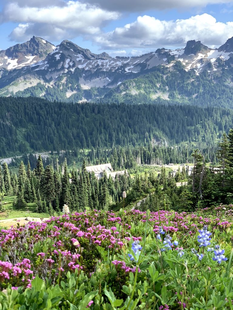
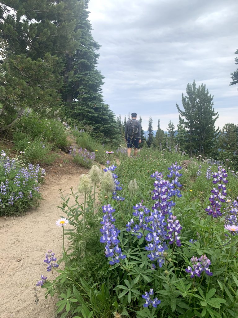
2:30pm – Skyline Trail Loop (5.5mi, 1450ft elevation gain)
First of all, ignore how we didn’t start on the trail until 2:30pm. This is because we sat in the parking lot for hours, waiting for the clouds to pass.
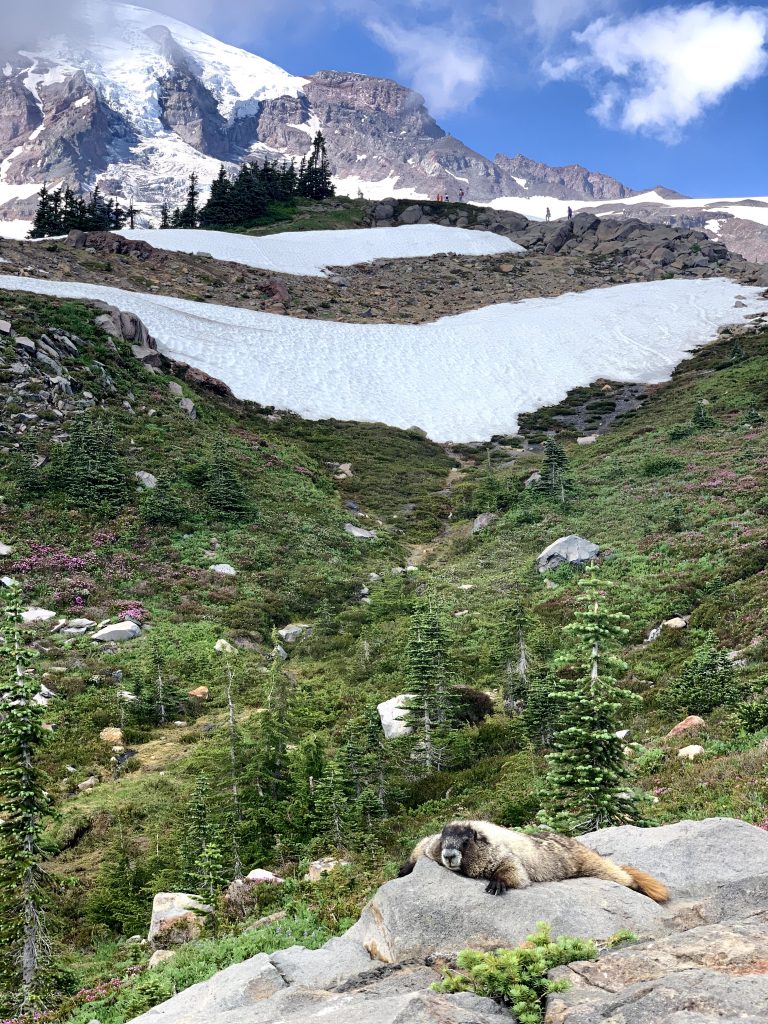
This trail is said to be one of the best in the park. It starts at the Henry M Jackson Visitor Center. You can take this either clockwise or counter-clockwise. We decided to do clockwise which takes you to Panorama Point first and the Myrtle Falls at the end. Both are highlights and have great views of Rainier in the background. The problem with going in the summer is that you’re going to spend hours finding the best photo of Rainier with wildflowers. You’ll spend countless time pausing on your hike thinking “Wow, this is a great backdrop of Rainier that’d be great for portrait photo with these wildflowers”. If you’re not pausing for wildflowers, you’re pausing for marmots! So many are roaming around and some are just lying around without a care in the world. This hike truly gives you a little bit of everything: animals, majestic mountain, flowers, and waterfalls.